Google Maps or Citymapper: Which One is Best for Your Daily Commute?
- June 16, 2025
- Tech

Table of Contents
- 1 Google Maps vs Citymapper: Which App is Easier to Access?
- 2 Citymapper App vs Google Maps: Which App is Best for Directions?
- 3 Google Maps vs Citymapper: Which App is Best for Accurate Location Details?
- 4 Citymapper App vs Google Maps: Additional Unique Features
- 5 FAQs
- 6 Which App Suits Your Travel Style?
One of the most popular debates among travel enthusiasts and regular city users is Google Maps vs Citymapper. Each app has advantages and usefulness, depending on the user’s requirements and devices.
Last year, when I was in New York. I was constantly switching between the two apps. New York City’s transit system is too giant, which is crucial when comparing Citymapper vs Google Maps NYC. That was when I first noticed that the Citymapper app is not preinstalled on my Apple 15 or Google devices; hence, the only option is installing it.
However, Google Maps is available on Android phones from the start. Citymapper, on the other hand, must be installed on both iOS and Android, provided your device supports iOS 15.0 or later or its Android equivalent. This is an important tech tip or guide when selecting a navigation app that perfectly fits your installation.
Lastly, a brief comparison may help you determine which app best suits your commuting, travelling, or exploring needs. Let’s dive in!
Google Maps vs Citymapper: Which App is Easier to Access?
Before downloading the app, ensure your city has the Citymapper app. While Google Maps is available worldwide and comes by default with almost every Android device, Citymapper has a relatively restricted range.
Now, Citymapper is present in approximately 31 countries and 107 cities worldwide. Europe has the densest coverage, with 71 European cities, making it a traveller’s best option.
It covers 27 cities in the United States, including major hubs like New York, San Francisco, and Chicago. At the same time, outside Europe and the U.S., Citymapper has 9 other cities in some other countries.
This makes Google Maps readily accessible, although Citymapper is more specific about its services. Before downloading the app, check the coverage map to see if your city is covered.
Citymapper App vs Google Maps: Which App is Best for Directions?

Google Maps and Citymapper offer different perspectives on navigation experiences. Google Maps is customizable as a navigation tool. It has superb driving instructions, coverage of the entire globe, and a detailed map of almost every place anywhere on Earth.
Citymapper, however, performs brilliantly in urban environments with useful, accurate, real-time public transportation with plenty of choices and multimodal travel options.
To compare based on how you travel, we categorized their navigation features into three categories: driving, public transport (including taxis, e-bikes, and ridesharing), and walking and cycling.
1. Driving
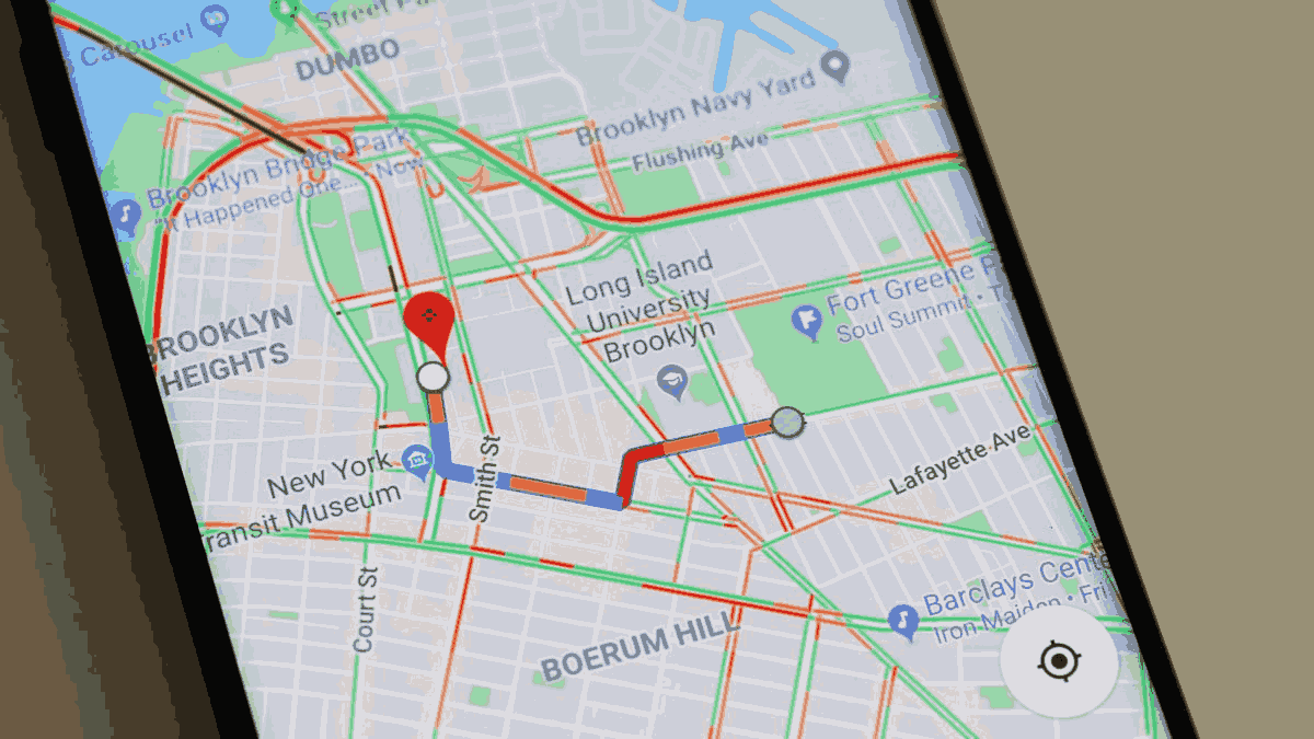
For navigation, Google Maps is the clear winner. It offers detailed directions on driving, current and accurate information on traffic, and excellent network coverage. That is why, although Citymapper does display traffic volume, it doesn’t give directions for driving, which is a significant disadvantage for those who are into driving a car. However, its traffic facility makes determining the street traffic level easier before heading out.
2. Public Transport
Citymapper is just amazing when it comes to public transport routing. While it doesn’t provide driving directions, it covers nearly all local transit options a user may require.
Users input their preferred starting location and the needed destination, and the application offers options by pricing, estimated time to reach, and schedule of the later trip.
For example, you can filter results based on speed, fewer transfers, or convenience side-by-side to compare buses, trams, and trains. While discussing the transportation options, Citymapper identifies how many stops are between you and the place you want to get to, which makes the planning much more straightforward.
Public transportation is also an option on Google Maps, but it offers fewer features and more straightforward navigation. Both apps are reliable, but Citymapper is slightly better because its information about public transport is even more accurate.
3. Walking and Cycling
Both apps provide similar routes and times for walking and cycling. Citymapper has an edge as it allows for unique features, such as tapping the main roads, which is safer and quicker in busy cities. For example, if you are walking late at night, you can put your earbuds on and follow the bright street lights, ensuring the route is well-lit and secure.
Citymapper also provides thorough cycling options, including three routes: Quiet, Regular, and Fast. It also offers accurate new walking times, city bike rentals, and more specific direction details.
Google Maps also provides features for walking and cycling but does not offer the same level of detail and flexibility for route customisation, which makes Citymapper preferable to these types of transport.
Google Maps vs Citymapper: Which App is Best for Accurate Location Details?
Google Maps allows users to obtain relatively comprehensive information about specific locations, which is helpful when organizing visits to certain places.
For instance, when I was new in New York City, I needed home essentials such as compact air fryers and wanted to purchase the Best TV for my living area. Using Google Maps, I got the convenience of identifying the nearby shops, their ratings, and the time when they open and close for business before moving out.
This combined feature helped me identify trustworthy stores and plan my trip without leaving room for guesswork.
However, Citymapper does not have these additional features integrated into the app; Citymapper only aims to give directions.
They are just as good for navigation as Google Maps, but they do not provide the level of detail that Google Maps does when it comes to places, so for the end user looking for more specifics in their travels, Google Maps is the better bet.
Citymapper App vs Google Maps: Additional Unique Features
Google Maps and Citymapper are two of the most valuable applications for navigating the city to different destinations, with some specific options added based on the app.
While Google Maps is suitable for every possible type of transportation, Citymapper is explicitly
built for metropolitan areas. Here are some notable unique features of each app:
Citymapper Features
Real-Time Transit Alerts – Get notified of delays, cancellations, strikes, etc.
Mixed Mode Routes – Combining walking, cycling, buses, trains, and even e-scooters into one route.
Stop Countdowns – Provides a count of stops between your current location and destination.
Weather Integration – This helps you view the weather in areas you’re going to along the route.
Three Cycling Routes – Quiet, Regular, and Fast – for those who like to choose.
Google Maps Features
Street View – 360-degree street-level views of landmark streets for better orientation.
Restaurant and Business Insights – Read reviews, menu, opening hours and ratings.
Offline Maps – Get maps to use when you have no internet connection. Find Nearby – Get recommendations for the best places to visit, eat, and shop around without searching for them.
FAQs
Google Maps vs Citymapper Cost: Which App is More Affordable?
Both applications are available for download and can be used for free on iOS and Android devices.
However, Citymapper contains features that users can subscribe to a paid service, like Citymapper Club, such as maps and other complex routes.
Google Maps, however, has no extra charges for any of its services, and all can be accessed for free.
Is the Citymapper App Free?
Yes, Citymapper is free for download on both iOS and Android devices.
Is Citymapper Owned by Google?
Google does not own Citymapper. It was acquired in March 2023 by Via Transportation.
Which App Suits Your Travel Style?
Choosing between Google Maps vs Citymapper all depends on the kind of traveler you are and what you are looking for in terms of travel. If you wish to have more versatile and detailed locations of places worldwide, there is no better app than Google Maps.
However, Citymapper is more suitable if you mainly commute in metropolitan areas and need timely information about trains/buses and travel options within a city.


